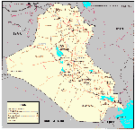


This is a partial inventory of major Iraqi special weapons facilities. Compilation of such an inventory is a surprisingly complex challenge. It is complicated by Iraqi concealment initiatives in the 1970s and 1980s, which remain surprisingly effective today. These operational security measures included extensive compartmentation of projects, assigning a variety of entity names to specific physical locations. Physical concealment measures during the 1980s included:
The correlation between commonly cited entity names and identifiable geographical place names is a persistent problem, which is compounded by inconsistencies in transliteration from Arabic to English. While UNSCOM inspectors eventually uncovered more than 20 sites involved in the Iraqi nuclear program, 16 of which were described as "main facilities," the Desert Storm target list on 16 January 1991 contained only two nuclear-related targets. Badush, Baiji, Al Qaim, Samarra, Akashat, Al Fallujah, Baghdad, Salman Pak, Musayyib, and Basra were identified as chemical and biological warfare related locations by USCENTCOM as of September 1990. [GulfLINK] But in the CIA Report on Intelligence Related to Gulf War Illnesses, [dated 2 August 1996], the number of sites suspected to have been connected to Iraq's chemical warfare program alone, totaled 34. UNSCOM conducted chemical weapons-related inspections at over 60 locations.
| Imagery | Locale | Entity | Latitude | Longitude | Nuclear | CW | Control | ||
 |
BW | Missile | |||||||
 |
Abu Ghurayb | Project 600 | 33�18'N | 44�16'E | |||||
| Akashat | 33�15'N | 40�35'E | |||||||
| Al Furat | 33�02'N | 44�03'E | |||||||
| Al Hadre | 35�18'N | 42�37'E | |||||||
 |
Al Haytham | 31�24'N | 46�05'E | ||||||
| Al Mamoun | 33�01'N | 44�13'E | |||||||
| Al Manal | Dawrah | 33�49'N | 44�42'E | ||||||
 |
Al Qaim | 34�22'N | 41�07'E | ||||||
| Al Safa | 33�25'N | 44�34'E | |||||||
| Al Sharqat | al-Fajr | 35�27'N | 43�16'E | ||||||
| An Nasiriyah | 31�02'N | 46�16'E | |||||||
| Aqaba | 33�08'N | 44�21'E | |||||||
| Baghdad | 33�20'N | 44�23'E | |||||||
| Baghdad | Radwaniyah Palace | 33�??'N | 44�??'E | ||||||
| Baghdad | Petrochemical-3 | 33�??'N | 44�??'E | ||||||
| Baghdad | al-Masbar | 33�??'N | 44�??'E | ||||||
| Baghdad | Nassr | 33�25'N | 44�23'E | ||||||
| Basrah | 30�30'N | 47�50'E | |||||||
| Darwah [Dora] | Al Farouq | 33�2?'N | 44�1?'E | ||||||
| Dhu Al Figar | 32�5?'N | 43�5?'E | |||||||
| Fallujah I | Habbaniyah I | 33�21'N | 43�46'E | ||||||
| Fallujah II | Habbaniyah II | 32�28'N | 43�39'E | ||||||
| Fallujah III | Habbaniyah III | 33�28'N | 43�47'E | ||||||
| Jabal Hamrin | Babylon | 34�30'N | 44�30'E | ||||||
| Jabal Makhul | 35�10'N | 43�25'E | |||||||
| Jurf as Sakhr | Al Hakam | 32�52'N | 44�13'E | ||||||
| Kamisiyah | Tall al Lahm | 30�46'N | 46�29'E | ||||||
| Karama | 33�2?'N | 44�1?'E | |||||||
| Latifiyah | 33�01'N | 44�10'E | |||||||
| Latifiyah | Taj al-Ma'arik | 33�01'N | 44�10'E | ||||||
| Mosul | Al Kindi / Saad-16 | 36�??'N | 43�??'E | ||||||
| Mosul | Al Jesira | 36�??'N | 43�??'E | ||||||
 |
Mosul | 36�20'N | 43�08'E | ||||||
| Muhammadiyat | 33�12'N | 42�28'E | |||||||
| Musayyib | Al Atheer | 32�46'N | 44�17'E | ||||||
| Osiraq | 33�12'N | 44�31'E | |||||||
 |
Rashidiya | Center for Engineering Design | 33�33'N | 44�22"E | |||||
| Salman Pak | 33�19'N | 44�10'E | |||||||
| Samarra | Muthanna | 33�50'N | 43�46'E | ||||||
 |
Shahiyat | Al Rafah | 33�03'N | 43�44'E | |||||
 |
Taji | Balat al Shuhada | 33�31'N | 44�16'E | |||||
| Taji | 33�33'N | 44�18'E | |||||||
| Tarmiya | Al Hareth | 33�40'N | 44�23'E | ||||||
 |
Tharthar | 33�43'N | 43�29'E | ||||||
 |
Tikrit | 34�36'N | 43�42'E | ||||||
 |
Tuwaitha | Al Asil / IAEC | 33�12'N | 44�31'E | |||||
| Yawm al Azim | Balat al Shuhada | 32�3?'N | 44�2?'E | ||||||
| Yusufiyah | Al Qa Qaa / Badr | 33�04'N | 44�15'E | ||||||
 |
Zafaraniyah | Dijla / Nida / Rabbiyah | 32�32'N | 46�29'E | |||||

