Index | Search |


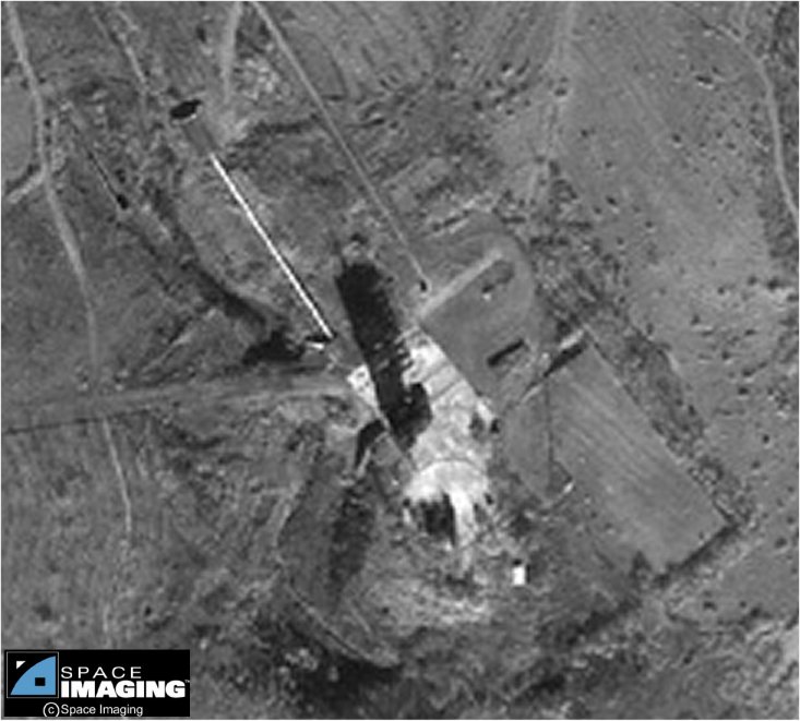
The launch pad consists of a cleared area, roughly 60 meters by 120 meters. The most prominent feature this the long shadow of the support gantry, which falls to the North of the gantry itself. The Northwest quadrant of this area is a paved surface, apparently of concrete, covering an area 30 meters by 40 meters. A fixed gantry is to the Southeast of the launch pedestal, while a flame bucket extends to the Southwest of the launch pedestal. The Southeastern end of the paved platform includes a circular structure some 30 meters in diameter. The central area of this circular feature includes a complex structure, the nature of which is disclosed neither by available satellite imagery nor by ground truth video.
The missile is transported to the launch pad from the Missile Assembly building via an upaved road, roughly 8 meters wide, that enters the launch pad area from the West. Smaller unpaved roads provide access to the pad area from the Northwest, and connect the launch pad to the possible Support Area to the North.
An apparent blockhouse, about 6 meters by 13 meters in extend, is located some 100 meters to the Northwest of the launch pedestal, and is connected to the launch pad proper by a clearly visible conduit, some 65 meters long and between 1 and 2 meters wide. Several small support structures are visible at various locations around the pad area, though their precise function is not evident. A pair of parallel tracks lead across the paved launch pad area to the launch pedestal, though these are evidently not associated with the gantry,
This one-meter resolution black-and-white image of Tae Po Dong, North Korea
was collected November 1, 1999 by Space Imaging's IKONOS satellite. The
image features the Tae Po Dong missile facility.
Credit: "spaceimaging.com."

